
Bridge Watchkeeping // Nautical Publications & IMO Treaties
10 Publications Every Navigator Must Know: Essential Admiralty, ICS, and IMO Bridge References
A practical master guide to the core nautical publications required aboard commercial merchant vessels. From Bridge Resource Management in the Bridge Procedures Guide and CATZOC data evaluation in NP231 to ALRS radio communication volumes, Admiralty Tide Tables, and emergency SAR protocols in IAMSAR Volume III.
A watchkeeper is not expected to memorize thousands of pages of hydrographic text. True seamanship lies in mastering the library’s architecture: knowing precisely which volume contains specific tactical information, interpreting it alongside electronic charts, and executing rapid operational decisions during bridge emergencies.
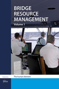
1. Bridge Procedures Guide (ICS)
Published by the International Chamber of Shipping (ICS), the BPG is far more than a collection of pre-arrival checklists. It defines the core philosophy of Bridge Resource Management (BRM) and bridge team integration. For junior officers, it offers vital operational frameworks: structured watch handovers, managing situational awareness during pilotage, establishing closed-loop communications, adhering to standard steering orders, monitoring safety with the BNWAS, and executing the “challenge and response” principle if master or pilot actions cause safety concerns.
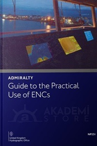
2. NP231 — ADMIRALTY Guide to the Practical Use of ENCs
In the era of paperless navigation, NP231 is the definitive guide for ECDIS operation. It bridges the gap between software button-pushing and hydrographic reality: assessing survey data quality via CATZOC (Category Zone of Confidence), calculating dynamic Safety Contour and Safety Depth settings, understanding why isolated underwater hazards can disappear under SCAMIN (scale minimum) filters, and preventing dangerous over-reliance on digital vectors.
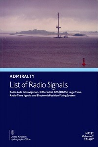
3. ALRS (Admiralty List of Radio Signals) — Volumes 1 through 6
This comprehensive six-volume Admiralty series governs ship-to-shore communications:
• Volumes 1 & 5: Coast radio stations, global GMDSS infrastructure, search and rescue contacts (MRCC), and satellite distress tracking via EPIRB systems;
• Volume 2: Navigational aids, radar beacons (Racons), radio direction finding, DGPS stations, and legal time signals;
• Volume 3: Maritime safety information (MSI), radio weather services, and Navtex schedules;
• Volume 6: Port operations, pilot service request protocols, mandatory reporting systems for Vessel Traffic Services (VTS), and precise Pilot Boarding Ground (PBG) geographical coordinates.
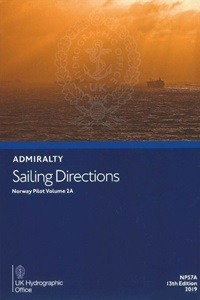
4. ADMIRALTY Sailing Directions (Pilots)
Navigational charts provide depths, lights, and contour vectors, but Sailing Directions reveal what cannot be drawn graphically: local current patterns, seasonal wind shifts, coastal bar behavior, abnormal optical refraction, environmentally sensitive anchorages, and restrictions in MARPOL Special Areas. Consulting the Pilot book is a mandatory prerequisite when appraising passages under IMO Resolution A.893(21).
5. ATT (Admiralty Tide Tables)
Despite widespread digital software packages like Admiralty TotalTide, manual calculation capability remains an essential navigational skill. Software errors or incorrect secondary port datum interpolations can cause significant grounding hazards. Manual tidal curve plotting enables accurate clearance computations in our UKC Calculator Online, ensuring safe transit through tidal windows framed by Abort Points and Points of No Return.
Quick Reference Matrix: Which Publication to Open in Operational Scenarios
| Operational Scenario | Primary Bridge Publication | Critical Data to Extract |
|---|---|---|
| Ocean Passage Appraisal | Ocean Passages for the World (NP136) | Great circle routes, seasonal storm tracks, ocean current systems. |
| Pilot Booking & VTS Check-in | ALRS Volume 6 | VHF working channels, notice periods (ETA), pilot station coordinates. |
| Unfamiliar Chart Symbol on Display | NP5011 (Paper) / NP5012 (ECDIS) | Symbol decoding, foul ground limits, obstruction clearances. |
| Preparation for Unfamiliar Berths | Guide to Port Entry | Berth length, maximum draft, air draft, line handling, tug capabilities. |
| Man Overboard / Distress Alert | IAMSAR Manual Volume III | Standard rescue turns, search patterns, on-scene coordination. |
6. The Mariner’s Handbook (NP100)
NP100 brings together operational maritime science: sea ice physics and ice accumulation risks, revolving tropical storm avoidance strategies, barometric tendency analysis, sea-state evaluation under the Beaufort Scale, and maritime territorial boundary definitions. When an officer observes unusual barometric shifts or atmospheric phenomena on the horizon, NP100 provides the physical explanation.

7. Ocean Passages for the World (NP136)
Before laying down waypoints on global routes, navigators consult NP136. It provides hydrographic routing data across major oceans, detailing recommended seasonal tracks for low- and high-powered vessels, trade wind belts, current velocities, and seasonal cyclonic activity. This volume bridges basic chart plotting with fuel-efficient, weather-resilient passage design.
8. Admiralty Guide to ENC Symbols used in ECDIS (NP5012)
The digital counterpart to traditional chart catalogues (such as NP5011 / US Chart No. 1). Under the IHO S-52 presentation library, ECDIS display symbols differ markedly from paper conventions. Officers must recognize simplified and traditional chart representations for wrecks, submerged rocks, swept depths, dredged channels, and traffic separation boundaries without relying solely on manual cursor pick-reports.
9. Guide to Port Entry
This practical reference links navigation with commercial port operations. It covers thousands of global terminals, detailing maximum permissible draft, LOA, beam, air draft under container cranes, water density, bollard pull requirements, bunkering availability, and waste reception procedures. Reviewing this data enables bridge teams to plan mooring configurations and verify requirements alongside our guide to the Pivot Point of a Ship.
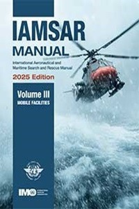
10. IAMSAR Manual Volume III (Mobile Facilities)
Jointly published by ICAO and the IMO, Volume III is carried aboard all commercial vessels under SOLAS Chapter V. When a distress call (Mayday) or Man Overboard alert sounds, officers must execute standardized recovery procedures immediately. Volume III contains standardized rescue turns (Williamson, Scharnov), mathematical search patterns (Expanding Square, Sector Search, Creeping Line), and communication protocols for acting as On-Scene Coordinator (OSC).
PSC Audits and Maintaining Publication Currency
As outlined in our guide to the 3rd Officer Handover Checklist, inspecting the currency of nautical publications is a primary focus for Port State Control (PSC) and vetting auditors under SIRE 2.0:
• Superseded Editions: Retaining outdated Sailing Directions or ALRS volumes when new editions have been issued by the hydrographic office;
• Uncorrected Paper Books: Missing manual pen-and-ink corrections from weekly Admiralty Notices to Mariners (NtM);
• Missing Digital Sync Logs: Failure to provide digital audit logs confirming synchronization of Admiralty Digital Publications (ADP) or e-Nautical Publications (e-NP);
• Inadequate Route Coverage: Undertaking a passage through waters where relevant volumes of Sailing Directions or radio signals are missing from the bridge inventory;
• No Independent Digital Backup: Operating electronic publications without an approved back-up PC connected to an uninterruptible power supply (UPS).
Frequently Asked Questions: Nautical Publications (FAQ)