
Navigation // Maritime Traffic Management & VTS Operations
Vessel Traffic Services (VTS): Types of Service (INS, NAS, TOS), Reporting Protocols, and ALRS Volume 6
A comprehensive professional guide to Vessel Traffic Services (VTS): legal foundations under SOLAS Chapter V Regulation 12, revised IMO Resolution A.1158(32), classification of core services (Information, Navigational Assistance, Traffic Organization), shore-based sensor suites, voice reporting procedures, and master-operator command demarcation.
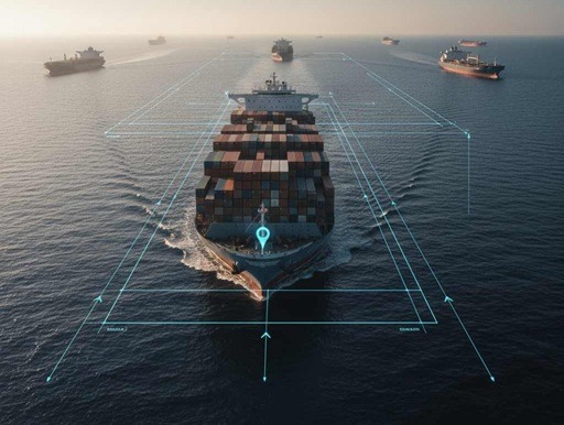
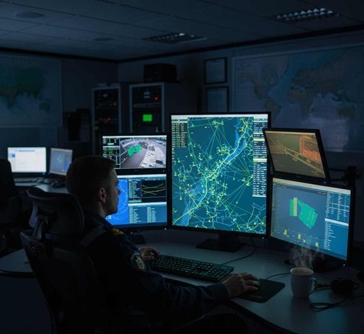
In congested fairways, port approaches, narrow straits, and Traffic Separation Schemes (TSS), autonomous onboard observation tools (Radar, ARPA, ECDIS) are complemented by centralized shore infrastructure. VTS builds a real-time Traffic Image, identifies developing collision and grounding hazards, manages port access priorities, and coordinates rescue and environmental responses.
1. Historical Evolution and International Regulatory Framework (IMO & IALA)
Early port traffic control relied on visual signals, semaphore arms, and optical flag hoists displayed from harbor watchtowers. Following the military development of radar during World War II, shore-based vessel tracking expanded rapidly:
- 1948–1949 (Port of Liverpool, UK): Installation of the world’s first dedicated shore-based surveillance radar to guide merchant vessels entering the Mersey estuary during thick fog;
- 1950 (Long Beach, California, USA): The first municipal shore radar tracking station commissioned in the United States;
- 1971–1972: Legislative milestones such as the Bridge-to-Bridge Radiotelephone Act (1971) and the Ports and Waterways Safety Act (1972) established mandatory VHF radio guard on dedicated bridge channels;
- 1997 (IMO Resolution A.857(20)): The international guideline formally defining the roles, functions, and operational boundaries of VTS.
In December 2021, the IMO Assembly formally adopted Resolution A.1158(32) — Guidelines for Vessel Traffic Services, which completely revoked and superseded Resolution A.857(20). This revised instrument aligns VTS terminology with the IMO e-Navigation strategy, integrates digital data exchange formats (IALA S-200 series), and updates standardized training frameworks for VTS personnel (IALA Model Course V-103).
Technical and engineering standards are established by the International Association of Marine Aids to Navigation and Lighthouse Authorities (IALA). Through publications such as IALA Standard G1089, IALA defines technical sensor tolerances, tracking accuracy, radar coverage overlap, and system redundancy worldwide.
2. Types of Services Provided by a VTS (INS, NAS, TOS)
Under IMO Resolution A.1158(32), VTS authorities provide three core services depending on geographic complexity, traffic volume, and immediate navigational circumstances:
| Service Category | Acronym | Scope and Tactical Purpose | Operational Initiation Criteria |
|---|---|---|---|
| Information Service | INS | Broadcasting vital navigational data: positions and movements of other traffic, meteorological observations, tidal windows, hazards to navigation, defective aids to navigation, and berth/anchorage availability. | Transmitted at scheduled broadcast intervals, on request by a vessel, or immediately when sudden safety-critical hazards arise. |
| Navigational Assistance Service | NAS | Guiding an individual vessel during difficult navigational situations: warning of imminent grounding, monitoring course deviations relative to fairways, and guiding ships during severe fog or onboard equipment failures (radar/gyro breakdowns). | Initiated upon the explicit request of the Master or prompted by the VTS operator when an immediate navigational danger is detected. |
| Traffic Organization Service | TOS | Active operational management of traffic movements: establishing fairway transit sequence, clearance times, speed limits, mandatory overtaking bans in narrow channels, and designated anchoring allocations. | Mandatory in high-density port approaches, narrow straits, and during the transit of deep-draught vessels or hazardous cargo carriers. |
A fundamental tenet of maritime law stipulates that no instruction, information, or advice issued by a VTS operator relieves the Master or Officer of the Watch (OOW) of their legal responsibility for the safe navigation of the vessel. The Master retains overriding authority and may decline VTS advice or instructions if executing them would compromise safety, notifying the VTS center of the deviation and rationale immediately.
3. Technical Sensor Suites of a Modern VTS System
The operational Traffic Image maintained by VTS centers is built by sensor fusion across multiple independent shore-side technologies:
High-resolution X-band and S-band solid-state radars provide precise target detection regardless of whether a target has an operational transponder. Advanced multi-sensor radar tracking processors compute Closest Point of Approach (CPA) and Time to CPA (TCPA) vectors across hundreds of active targets. Test your own radar plotting knowledge via the ARPA Simulator Online.
Shore-based AIS stations receive Class A transponder data (MMSI, call sign, coordinates, Speed Over Ground, Course Over Ground, draft, dangerous cargo details). In addition, VTS operators can project synthetic or Virtual Aids to Navigation (Virtual AtoNs) directly onto navigators’ electronic chart screens (ECDIS).
When a vessel transmits over an allocated VHF working frequency, shore-based VHF direction finders compute the line of bearing to the transmitting antenna. The computed line overlays the operator’s display, resolving target identity during crowded anchorage conditions.
Long-range daylight pan-tilt-zoom cameras and cooled infrared sensors provide visual confirmation of vessel draft marks, deck cargo lashings, smoke emissions, towline configurations, and boarding operations during marine pilotage transfers.
4. Navigation Within a VTS Area: Reporting Regimes and Radio Discipline
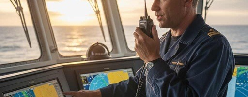
While transiting a VTS area, vessels are required to maintain a continuous listening watch on the designated VHF Sector Working Channel and on VHF Channel 16.
Mandatory Reporting Events:
- Initial Report (Pre-entry): Transmitted 1 to 2 hours prior to reaching the VTS area boundary (reporting vessel name, call sign, maximum draft, air draft, hazardous cargo class, and destination);
- Waypoints / Calling-in Points (CIP): Transmitted when crossing designated geographic lines or channel markers as marked on nautical charts;
- Operational Status Changes: Anchoring, weighing anchor, securing to berth, casting off lines, taking or dropping the pilot;
- Emergency and Safety Incidents: Steering gear breakdown, blackout, dragging anchor, fire, hull ingress, or a man overboard incident.
To prevent misinterpretation over VHF radio, communication should be structured using the eight IMO Message Markers: Information, Warning, Advice, Instruction, Question, Answer, Request, Intention. Bridge watchstanders should adhere to standard voice communication commands as outlined in Helmsman Watch & Steering Orders.
5. Where to Find Official VTS Information: ALRS Volume 6 & ADRS6
During voyage appraisal and execution, bridge teams identify applicable VTS requirements using official hydrographic nautical publications:
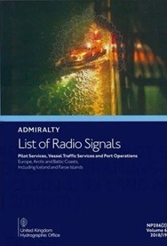
• Geographic coverage boundaries and territorial limits of VTS sectors;
• Designated VHF channels for calling, working, radar assistance, and emergency traffic;
• Precise geographic coordinates and names of mandatory Calling-in Points (CIPs);
• Advance notice timelines (e.g., 24h, 12h, 4h, and 2h pre-arrival notices);
• Official contact details (telephone, email, web portal) and operational language preferences;
• The digital equivalent — Admiralty Digital Radio Signals 6 (ADRS6) — receives weekly digital updates via satellite communications.
Frequently Asked Questions: Vessel Traffic Services (FAQ)