
Ship Technologies // Marine Electronics & Navigation
Digital Technologies in Shipping: Tools for Professional Seafarers
Modern shipping is developing rapidly thanks to the implementation of digital technologies that make navigation more accurate, enhance crew safety, and help manage vessels more effectively. While seafarers previously relied mainly on paper charts, visual observations, and traditional navigational instruments, today they have a comprehensive suite of electronic systems at their disposal. Echo sounders, satellite navigation, electronic chart systems, automatic vessel identification, and digital communication tools have become essential instruments for professional work on the water.

Echo Sounder — Depth Control and Boat Safety
An echo sounder is one of the key devices used to determine the depth under a boat’s keel. Its operating principle is based on emitting acoustic pulses that reflect off the seabed and return to the transducer. Based on the signal transit time, the instrument calculates the distance to the underwater surface.
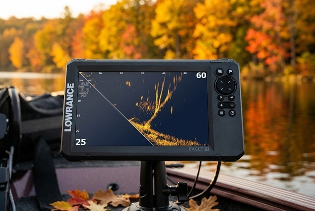
For professional seafarers, the echo sounder is of particular importance when navigating shallow waters, entering ports, transiting narrow channels, and maneuvering in unfamiliar waters. It helps detect decreasing depths in a timely manner and reduces the risk of running aground. Among marine navigation solutions, Lowrance echo sounders (https://lowrance.com.ua/ru/ekholoti/) deserve special attention, combining advanced underwater imaging technologies with a user-friendly interface. Depending on the model, they allow obtaining detailed information about depth and bottom topography, as well as utilizing additional features to enhance navigational awareness.
Modern models are capable of displaying bottom topography changes in real time, storing measurement data, and integrating with other navigational systems. However, echo sounder readings must be assessed taking into account the transducer installation location, vessel draft, water conditions, and equipment specifications. It complements navigational charts, but does not replace them.
GPS — Accurate Positioning
The GPS satellite navigation system allows determining vessel coordinates, speed, and direction of movement. The acquired data is used for route planning, cross-track error monitoring, and estimated time of arrival (ETA) calculation.
For the master and the officer of the watch, GPS is particularly essential during long passages, navigation in adverse weather conditions, and port approaches. Modern navigation receivers provide continuous coordinate updates and can interface with electronic charts, radars, and other shipboard systems, helping the bridge team navigate across various operational conditions.
At the same time, a professional mariner must account for the possibility of satellite signal loss, interference, or navigation data spoofing. Therefore, GPS readings must be cross-checked against radar information, visual bearings, and other available means of monitoring. Such an integrated approach enhances navigation accuracy and navigational safety.
Electronic Chart Display and Information Systems (ECDIS)
ECDIS (Electronic Chart Display and Information System) is an electronic navigational information system that displays the vessel’s route on electronic navigational charts.
It allows passage planning in advance, setting waypoints, monitoring the vessel’s actual position, and receiving alerts regarding potentially hazardous areas. When properly configured, the system helps identify risks associated with shallow depths, navigational hazards, and deviations from the planned track.
ECDIS significantly streamlines work with navigational information; however, it requires regular chart updates and proper setup of safety parameters. The responsibility for route monitoring and decision-making remains with the crew.
Automatic Identification System (AIS)
AIS (Automatic Identification System) is designed for exchanging information between vessels and shore authorities. The system broadcasts vessel identification data, coordinates, course, speed, and other parameters.
Thanks to AIS, seafarers can assess the movement of surrounding traffic, identify close-quarters situations, and coordinate maneuvers in congested shipping areas. This data is particularly valuable in restricted visibility and high-density traffic.
It is important to remember that AIS does not transmit information about every waterborne object, and the transmitted data may be incomplete or inaccurate. Therefore, the system is used in conjunction with radar and visual lookout.
Radar and Automatic Radar Plotting Aid (ARPA)
Radar allows detecting vessels, coastlines, aids to navigation, and other targets regardless of ambient light. It is particularly crucial at night, in fog, rain, and restricted visibility.
The ARPA (Automatic Radar Plotting Aid) system automatically tracks radar targets, calculates their motion vectors, and assists in assessing collision risk. This enables the officer of the watch to make timely decisions for safe collision avoidance.
Despite a high level of automation, radar performance depends on tuning, radio wave propagation conditions, and target characteristics. Therefore, a mariner requires solid skills in interpreting radar data.
Digital Communications and Boat Monitoring Systems
Satellite communications ensure message exchange between the ship and shore even in remote ocean regions. It is used for receiving weather forecasts, obtaining routing instructions, distress and emergency communications, and exchanging operational documentation.
Additional capabilities are provided by vessel technical condition monitoring systems. Sensors monitor engine performance, fuel consumption, temperature, and pressure across various systems. Analyzing this data helps detect equipment faults early, schedule preventative maintenance, and optimize operating costs.
From Electronic Devices to Effective Ship Management
Digital technologies have become an integral part of modern shipping. Echo sounders, satellite navigation, ECDIS, AIS, radar, and monitoring systems provide seafarers with access to precise, real-time information essential for safe vessel operation.
However, the efficiency of digital tools depends not only on the technical capabilities of the equipment, but also on the crew’s qualifications. A professional mariner must be proficient in operating electronic systems, verifying the acquired data, and remaining prepared to act in the event of equipment failure. It is the combination of modern technology, practical experience, and sound decision-making that enhances maritime safety and the operational efficiency of the fleet.
Source: https://kolibri.kiev.ua/ru/